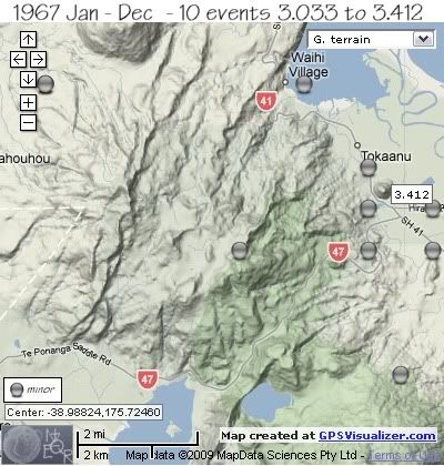
The other quake of 1967 was located under the lower NE slopes of Mt. Pihanga
The map below shows the locations;

REF, LAT, LONG, TIME, DEPTH, MAG
* same location
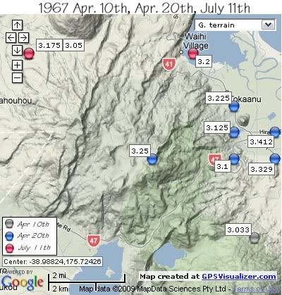
1549534, -39.02, 175.78, 1967/04/10 14:36:26.3, 12, 3.033
1549547, -38.99, 175.78999, 1967/04/20 04:44:45.2, 12, 3.329
1549549, -38.99, 175.77, 1967/04/20 04:49:02.9, 12, 3.1
1549552, -38.98, 175.78999, 1967/04/20 05:56:24.9, 12, 3.412
1549553, -38.98, 175.77, 1967/04/20 06:04:20.6, 12, 3.125
1549555, -38.97, 175.77, 1967/04/20 07:22:31.6, 12, 3.225
1549556, -38.99, 175.73, 1967/04/20 08:07:57.0, 12, 3.25
1549671, -38.95, 175.67, 1967/07/11 06:22:55.9, 12, 3.05 *
1549673, -38.95, 175.67, 1967/07/11 08:19:53.0, 12, 3.175 *
1549674, -38.95, 175.75, 1967/07/11 08:54:44.0, 12, 3.2
The map below shows the same events separated by date
( colour of orbs denotes dates as per key on map)

data by geonet. map by google maps. plots by highace using GPS Visualizer

No comments:
Post a Comment