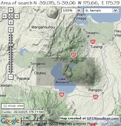
Whilst there were earthquakes outside this study area during the same periods of time, I have kept to the perameters which cover the Western and Upper reaches of Lake Rotoaira, across the Ponanga Saddle between Lake Rotopounamu and Mt Tihia, to Mt Pihanga in the east for clarity.
The maps below show the search areas as a darker shade.


Geography.
The Tongariro Volcanic Centre occupies the southern 65km of the Taupo Volcanic Zone and comprises three main volcanic complexes. In the north, the large cones of Pihanga (1,304m), Kakaramea (1,280m) and Tihia (1,147m) and smaller cones Puketopo (930m) and Pukemohono (795m) within what is known as the Rotopounamu Graben, all are extinct and are aligned NW-SE for about 10km.
The Rotopounamu Graben was formed approx. 2000 years ago after major eruptive acticity on the Tongariro Massif ceased. There are two un-named fault lines of uncertain age that run NNE-SSW on the east and west sides of Lake Rotopounamu. The lake may be consequent on ponding of drainage and so post date the faulting or it may have been an explosion crater.
Lake Rotopounamu is approx 1m2 in area and with a maximum depth of 7.5m.
South of Lake Rotopounamu are two un-named cones known as Onepoto Craters, a minimum age of 20,000 years is suggested for all cones and domes in the Rotopounamu Graben area.
Deformation of the southern part of the Taupo Volcanic Zone in repect to the Kaimanawa Range to the east is estimated at an average rate of 2.1metres per thousand years.
Recent scientific work indicates that the earth's crust below the Taupo Volcanic Zone may be as little as 16 kilometres thick. A film of Magma 50 kilometres (30 mi) wide and 160 kilometres (100 mi) long lies 10 kilometres under the surface.
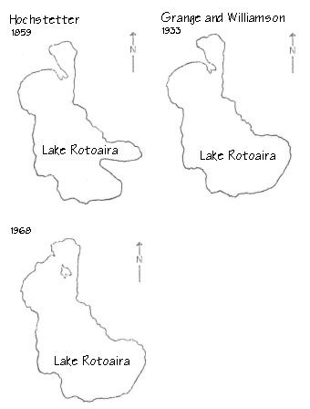
Local deformation within the Rotoaira/Rotopounamu Graben is known in historic times. Hochstetter’s 1864 sketch map of Lake Rotoaira shows two peninsulas extending into the lake, one at the southestern end and another at the northwestern end connecting with Motuopuhi Island.
In 1933 Grange and Williamson published a map of the area and the southeastern peninsula had disappeared but the northwestern peninsula persisted.
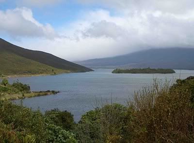
Since 1973 the end of the northwestern peninsula has become separated to form Motuopuhi Island. The area of Lake Rotoaira is therefore gradually extending as this part of the graben becomes further depressed.


No comments:
Post a Comment